British Battles 493-937

British Battles: Badon to Brunanburh

This new book by renowned philologist Andrew Breeze is a collection of thirteen studies on battles fought in various parts of early medieval Britain. Employing his deep knowledge of place-names and primary sources, Professor Breeze proposes for each battle a geographical context that either supports or challenges previous scholarship. Most of the thirteen chapters are updated or reworked versions of articles previously published in academic journals. Although the author’s conclusions will be familiar to anyone who has followed his research in recent years, it is useful to have them collected in one place, not least because some of the original articles are not easy to find without access to a university library’s journal archives.

A number of famous ‘lost’ battles are discussed in the book, among them Degsastan (AD 603), Maserfelth (642) and Brunanburh (937). These three have yet to be placed on a map with any measure of confidence or consensus, despite much debate and many competing theories. The locations suggested by Breeze are, respectively, Dawyck (Scottish Borders), Forden (Powys) and Lanchester (County Durham). In making a case for Brunanburh (‘Fort of Bruna’?) being the Roman fort of Lanchester (Longovicium) near the River Browney, Breeze offers a challenge to the popular belief that the battle was fought at present-day Bromborough on the Wirral Peninsula in Cheshire. In so doing, he shows that the debate is far from settled and that Bromborough is not the only place for which a strong case can be made. Less widely-known than Brunanburh is the battle of Arfderydd (573), an event associated with the earliest strands of the Merlin legend. Breeze supports a long-established consensus that it was fought in the vicinity of Arthuret, an ancient parish eight miles north of Carlisle.

The book’s first two chapters deal with battles traditionally associated with a sixth-century warlord called Arthur, a shadowy figure who appears in early medieval Welsh texts such as the ninth-century Historia Brittonum (‘History of the Britons’). The warlord lies at the root of later legends about a fabled king whose chivalrous knights sat at the Round Table in Camelot. Many people believe – or want to believe – that the legends are rooted in fact, and that the warlord of early Welsh tradition was a real historical figure. This is the position adopted by Breeze, who suggests that the original Arthur was a Briton of the North who undertook a series of military campaigns in the early sixth century. He argues that these campaigns, a dozen of which are listed in Historia Brittonum, were fought in what are now southern Scotland and adjacent parts of northern England. Breeze believes that previous attempts to locate the most obscure battles in the list – such as ‘Bassas’ and ‘Mount Agned’ – have been heading in the wrong direction, hence these places remain unidentified. He believes that their names are corrupt and garbled, requiring correction to forms that make more sense. This leads him to propose entirely new identifications. Bassas, for example, he sees as an error for Tarras, which he associates with Tarras Water in Dumfriesshire or Carstairs in South Lanarkshire (Casteltarras in 1172). He believes ‘Agned’ to be a corruption of Agheu (‘death’ in Old Welsh), a name he associates with the lost place-name Penango (‘Hill of Death’?) in the Scottish Borders. Other names in the Historia Brittonum list are more straightforward and potentially easier to locate, an example being the river ‘Dubglas’ which a number of scholars – including Breeze – identify as the Douglas Water in south-west Scotland. The final battle in the list is a great victory over the Anglo-Saxons at ‘Mount Badon’. Breeze completely uncouples Badon from Arthur’s catalogue of victories, attributing it instead to the fifth-century warlord Ambrosius Aurelianus. He sees the name Badon as an error for Braydon and locates the battlefield at Ringsbury hillfort near Braydon Forest in Wiltshire. Camlan or Camlann, the battle where Arthur is said to have received a mortal wound, is absent from the Historia Brittonum list but appears in the tenth-century Welsh Annals where it is entered at the year 537. Breeze puts Camlan in the vicinity of Hadrian’s Wall, supporting the long-established candidacy of Camboglanna, a Roman fort at Castlesteads near the western end of the frontier.

While Arthur’s campaigns may be familiar to many readers of this book, other battles have received less widespread attention. Two ninth-century encounters between English and Scandinavian forces at ‘Alluthèlia’ (844) and ‘Buttingtune’ (893) fall into this category, but Breeze’s discussion of their historical and geographical contexts is nonetheless illuminating. He locates the former at Bishop Auckland in County Durham, the latter at Buttington in Powys, and shows why both battles should be regarded as significant events in the story of Viking-Age Britain. From an earlier time comes another obscure battle, fought at a place called ‘Gwen Ystrad’ by the mysterious King Urien of Rheged (c.590). Breeze identifies Gwen Ystrad as the valley of the River Winster in Cumbria, a location suggested by others but here strengthened by the author’s considerable philological expertise. Slightly better known is the seventh-century Northumbrian victory at ‘Uinued’ (or ‘Winwaed’) where King Penda of Mercia met his doom. Breeze puts the battlefield beside the River Went in Yorkshire, adding weight to a long-established case supported by many historians.

One aspect of Breeze’s papers that I have always found particularly useful is his comprehensive summarising of previous scholarship on the subject in question. This gives the reader a good measure of background information, while placing Breeze’s own contribution in a broader context, as well as signposting additional resources and alternative theories. The summaries usually begin with antiquarian musings of the seventeenth, eighteenth and nineteenth centuries, before following a trail of study through to the most recent academic discussions. Breeze often acknowledges the work of independent researchers whose contributions to scholarship might otherwise be overlooked.

On the back cover we are told that the book’s impact on scholarship ‘will mean the rewriting of much early British and Anglo-Saxon history’. It is a bold claim, reflecting the author’s confidence in his conclusions. Not everyone will agree with all of his identifications and reinterpretations, especially if they have strong views of their own on where a particular conflict was fought. But this is a book that anyone with an interest in locating the lost battlefields of early medieval Britain will find enlightening and thought-provoking.

* * * * *

Andrew Breeze, British Battles 493-937: Mount Badon to Brunanburh (Anthem Press, 2020) [link to publisher’s website]

List of chapters:
1. 493: British Triumph at Mount Badon or Braydon, Wiltshire.
2. 537: Arthur’s Death at Camlan or Castlesteads, Cumbria.
3. 573: Legends of Merlin and Arfderydd or Arthuret, Cumbria.
4. c.590: Picts at Gwen Ystrad or the River Winster, Cumbria.
5. 603: Carnage at Degsastan by Wester Dawyck, Borders.
6. 613: Chester and the Massacre of Welsh Monks.
7. 633: Hatfield Chase and British Victory at Doncaster.
8. 634: Hefenfeld and British Defeat in Northumberland.
9. 642: Maserfelth and King Oswald’s Death at Forden, Powys.
10. 655: Treasure Lost on the Uinued or River Went, Yorkshire.
11. 844: Vikings, ‘Alluthèlia’ and a Bridge at Bishop Auckland.
12. 893: Vikings Liquidated at Buttington, Powys.
13. 937: ‘Brunanburh’ and English Triumph at Lanchester, County Durham.

Professor Breeze’s ideas on some of these battles have been previously discussed here at Senchus. The links below will take you to the relevant blogposts:
Arthur’s victories
Gwen Ystrad
Brunanburh

* * * * * * *

The Battle of Gwen Ystrat

Six years ago, in a post at this blog, I discussed the battles of Catraeth and Gwen Ystrat. The former is mentioned in a medieval Welsh poem (or group of poems) known as Y Gododdin (‘The Gododdin’) where it is presented as a defeat for the Britons of Edinburgh at the hands of Anglo-Saxon foes. Gwen Ystrat was the scene of a victory for the North British king Urien Rheged, apparently over Pictish enemies, in a poem attributed to the bard Taliesin. The poem has the title Gueith Gwen Ystrat (Welsh gueith = ‘strife, battle’) and its historical setting is the sixth century AD.

In my blogpost from 2009, I referred to a suggestion by the Celtic scholar John Koch that the battles of Catraeth and Gwen Ystrat were one and the same. I also mentioned an objection to this idea by Graham Isaac, who proposed that Gueith Gwen Ystrat should be seen not as an authentic poem from sixth-century North Britain but as an ‘antiquarian’ composition from eleventh-century Wales. I ended the blogpost on a rather sceptical note, sharing Isaac’s doubts as to whether the battle of Gwen Ystrat was a historical event rather than a literary creation.

Fast forward to 2015 and to the latest issue of the journal Northern History. This contains an article by Andrew Breeze in which the case for seeing Gueith Gwen Ystrat as a genuine North British poem of the sixth century is re-stated. Professor Breeze also discusses the possibility that the battle may have been fought in the valley of the River Winster in southern Cumbria. This idea was first proposed by the nineteenth-century Welsh scholar Thomas Stephens who observed that another poem attributed to Taliesin mentions a place called Gwensteri as the scene of a battle fought by a northern king called Gwallawg. Stephens wondered if Gwensteri might be an error for Gwen Ystrat and suggested that both names refer to Winsterdale. Breeze thinks Stephens was right to identify Gwensteri as the River Winster but sees the name Gwen Ystrad as an error for Gwensteri rather than the other way around. He proposes Gwensteri as a native Celtic (Brittonic) name for the Winster.

Other river-names in Cumbria certainly have names of Celtic origin but Winster has generally been regarded as Norse. An explanation of this name based on Norse vinstri (‘left’) was suggested by the Swedish philologist Eilert Ekwall nearly 100 years ago but Andrew Breeze thinks a more likely base is Brittonic gwen (‘white’). A name with the simple meaning ‘white river’ does indeed seem more likely than the harder-to-explain ‘left-hand river’. Taliesin’s poem also mentions a place called Llech Wen (‘White Stone’?) which Breeze identifies as Whitbarrow, a high fell on the east side of Winsterdale. Whitbarrow has a name of Anglo-Saxon origin meaning ‘White Hill’ and a prominent crag called White Scar.

Placing the battle beside the River Winster fits with Breeze’s broader vision of the geography of Urien’s kingdom (Rheged) which he envisages as straddling the Pennine hills to encompass parts of Yorkshire and Cumbria. This is in keeping with a consensus view on sixth-century political geography in which Urien is envisaged as ruling an extensive realm centred on the Solway Firth. I am not with the majority on this matter, nor do I think the name ‘Rheged’ can be written on a map with any measure of confidence – or without an accompanying question mark. The reasoning behind my scepticism (or heresy?) is set out in my book The Men of the North.

Andrew Breeze makes a good case for amending Gwen Ystrad to Gwensteri and for identifying the latter as a Celtic name for the Cumbrian river Winster. His article builds on his other recent work on the Old North and adds further weight to conventional opinion on the location of Urien’s realm. Heretical voices, such as mine, can only respond with a rather pessimistic view on the authenticity of Taliesin’s poems, or with the bleak suggestion that Rheged’s geography might be irretrievably lost.

River Winster

* * * * *

References

Andrew Breeze, ‘Urien Rheged and Battle at Gwen Ystrad’ Northern History 52 (March 2015), 9-19. [I am grateful to Andrew Breeze for sending me a copy of this article]

Other Rheged-related articles by Andrew Breeze….
‘The Names of Rheged’ Transactions of the Dumfriesshire and Galloway Natural History and Antiquarian Society 86 (2012), 51-62.
‘Early Welsh Poetry and Rossett, Cumbria’ Northern History 49 (2012), 129-34.
‘Northumbria and the Family of Rhun’ Northern History 50 (2013), 170-9.
‘Yrechwydd and the River Ribble’ Northern History 47 (2010), 319-28.

Graham Isaac, ‘Gweith Gwen Ystrat and the Northern Heroic Age of the Sixth Century’ Cambrian Medieval Celtic Studies 36 (1998), 61-70.

Tim Clarkson, The Men of the North: the Britons of Southern Scotland (Edinburgh, 2010) [see pp.68-78 for a discussion of Rheged]

My blogpost from 2009: Catraeth and Gwen Ystrat.

* * * * * * *

Stones of the Britons

Clach nam Breatann

Clach nam Breatann (© David Dorren 1998)


One of the main roads to the Scottish Highlands is the A82 which carries travellers from Glasgow to Inverness via Fort William. After leaving the outskirts of Glasgow, this well-known highway passes Dumbarton and Alexandria before running north along the side of Loch Lomond. The loch is eventually left behind as the A82 continues onward through Glen Falloch to Crianlarich and Tyndrum.

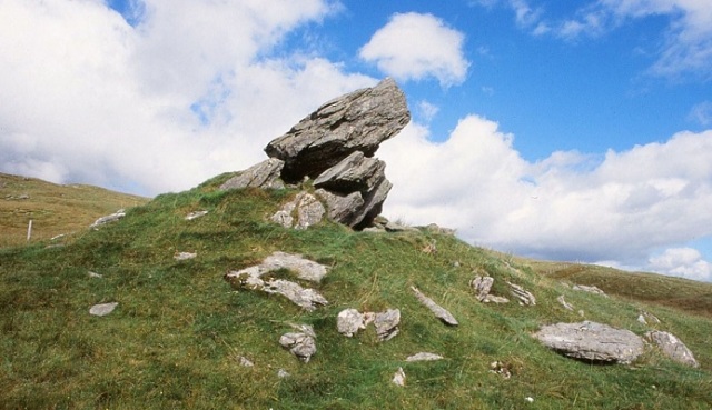
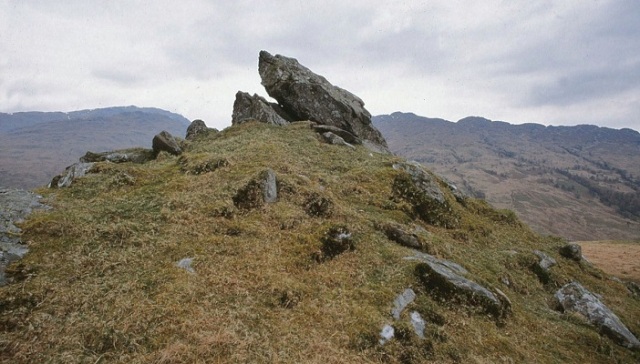
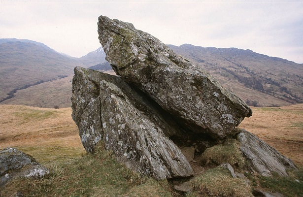
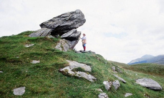
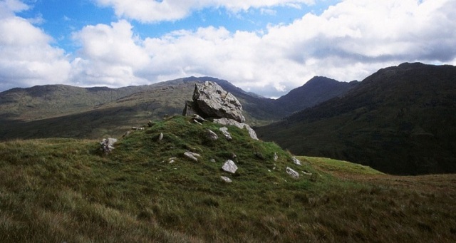
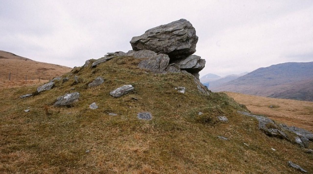
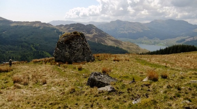
High up on the western slopes of Glen Falloch, on the opposite side from the picturesque Falls, stands Clach nam Breatann, ‘The Stone of the Britons’. Like a space-rocket ready to launch, this enigmatic monument leans up from its base to point towards the sky. The topmost piece or capstone rests on deep-set boulders that seem to grow out of the ground. These foundations are sunk so deeply in the hillside that they might indeed be a natural rocky outcrop. The whole assemblage sits on a conical mound of earth and stone which appears to be partly man-made, like a large cairn now covered with grass.

Clach nam Breatann

Clach nam Breatann (© David Dorren 2002)

Clach nam Breatann

Clach nam Breatann (© David Dorren 2002)

Tradition asserts that Clach nam Breatann marked the boundary between Picts, Scots and Britons. Its association with the latter suggests that it lay within their territory and therefore belonged to them in some way. Historians generally assume that it defined the northern limit of the kingdom of Alt Clut or Dumbarton (c.400-870 AD) and also of the successor realm Strat Clut or Strathclyde (c.870-1070). The assumption is no doubt correct, although we should also keep in mind the possibility that the stone simply commemorated a famous battle involving the Britons. In the nineteenth century, the Scottish antiquary W.F. Skene suggested that an unidentified ‘Stone of Minuirc’, scene of a battle between Scots and Britons in 717, may have been Clach nam Breatann. The geographical setting of Glen Falloch would certainly be consistent with a frontier clash between opposing forces from Dál Riata and Clydesdale, but Skene’s theory was only a guess and Minuirc remains elusive.

Clach nam Breatann

Clach nam Breatann (© David Dorren 1998)

I visited Clach nam Breatann some fifteen years ago. I had never seen anything quite like it before. Not only did it look imposing and ancient, it also had a strangeness, an eccentricity, that I found hard to explain. Since then, I’ve mentioned the stone in my book The Men of the North (with an accompanying photograph) and in several posts at this blog. I would like to make a return visit, to refresh my memory and to take more pictures. Getting there is by no means easy, for the approach involves a trek up a steep hillside over rough, boggy terrain. However, the effort is definitely worth it, especially on a clear day when the view is truly breathtaking.

Clach nam Breatann

Clach nam Breatann (© David Dorren 1998)

Clach nam Breatann

Clach nam Breatann (© David Dorren 2002)

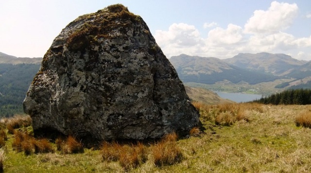
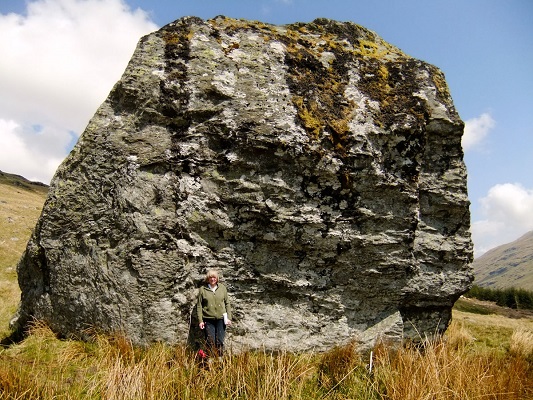
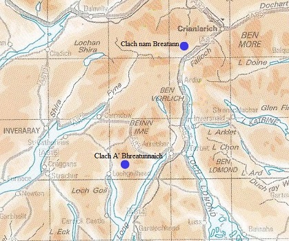
As well as re-visiting Clach nam Breatann, I’m keen to see another impressive landmark for the first time. This is a gigantic boulder known as Clach A’ Bhreatunnaich, ‘The Briton’s Stone’, a glacial erratic nestling on the southern flank of Ben Donich near Lochgoilhead. As with Clach nam Breatann, tradition asserts that this solitary megalith stands on an ancient boundary between the Clyde Britons and their neighbours – in this case, the Scots of Cowal. Both stones may in fact be part of a single frontier – they are, after all, only 12 miles apart. The possible course of such a divide was traced by the late Betty Rennie who published her findings in the Pictish Arts Society Journal in 1996 (see reference below). Rennie’s pioneering work on ancient boundaries has been continued by two of her former colleagues in the Cowal Archaeological Society – David Dorren and Nina Henry – whose research on the mysterious Druim Alban (‘Ridge of Alba’) was highlighted in an earlier post at this blog.

The following images of Clach A’ Bhreatunnaich give a good idea of its size and of its position in the landscape.

Clach A' Bhreatunnaich

Clach A’ Bhreatunnaich (© David Dorren 2010)

Clach A' Bhreatunnaich

Clach A’ Bhreatunnaich (© David Dorren 2010)

Clach A' Bhreatunnaich

Clach A’ Bhreatunnaich (© David Dorren 2010)

Clach A' Bhreatunnaich

Clach A’ Bhreatunnaich (© David Dorren 2010)

Clach A' Bhreatunnaich

Clach A’ Bhreatunnaich (© David Dorren 2010)

Clach A' Bhreatunnaich

Clach A’ Bhreatunnaich (© David Dorren 2010)

Clach A' Bhreatunnaich

Clach A’ Bhreatunnaich (© David Dorren 1999)

Stones of the Britons

* * * * *

Notes & references

I am again grateful to Dr David Dorren for allowing me to reproduce his photographs here at Senchus.

Elizabeth B. Rennie, ‘A possible boundary between Dál Riata and Pictland’ Pictish Arts Society Journal 10 (Winter 1996), 17-22.

Armand D. Lacaille, ‘Ardlui megaliths and their associations’ Proceedings of the Society of Antiquaries of Scotland, vol.63 (1929), 329-32. [This article describes Clach nam Breatann and can be accessed via the PSAS online archive]

A link to my blogpost on Druim Alban.

Entries on the Canmore database for Clach nam Breatann (under its alternative name Clach na Briton) and Clach A’ Bhreatunnaich.

From the Annals of Ulster, under the year 717:
Congressio Dal Riati & Brittonum in lapide qui uocatur Minuirc, & Britones deuicti sunt.
(‘An encounter between Dál Riata and the Britons at the rock called Minuirc, and the Britons were defeated.’)

* * * * * * *

This post is part of the Kingdom of Strathclyde series:

Kingdom of Strathclyde

* * * * * * *

Ghosts of Nechtanesmere

Dunnichen Moss

Dunnichen Moss, looking north towards Dunnichen Hill (Photograph © B Keeling).


On 20 May 685, at Dun Nechtáin (‘Nechtan’s Fortress’), an English army from Northumbria was massacred while advancing deep into Pictish territory. As well as being associated with a fortification, the battle was also close to an area of wetland known as Linn Garan (‘Heron Pool’ in the ancient Brittonic language of the Picts) and as Nechtanesmere (Old English: ‘Nechtan’s Mire’).

The location of the battlefield is a matter of debate. Some historians place it near Dunnichen Hill in Angus; others look further north to Dunachton in Badenoch. My own preference is for the Angus site, although I continue to keep an open mind.

Many years ago, while reading Graeme Cruickshank’s 1991 booklet on the battle, I encountered an intriguing tale, a sort of Pictish ghost-story. This told of a strange apparition allegedly seen by Miss E.F. Smith, a resident of the village of Letham, after her car skidded off the road on a dark night in January 1950. According to Miss Smith, she left her vehicle in a ditch and began the 8-mile walk home, taking a route along unlit country roads. Eventually, just before 2.00am, she drew near the outskirts of Letham and saw the black shape of Dunnichen Hill looming ahead. It was then that she noticed shadowy lights moving in nearby farmland. These gradually became clear, to be revealed as flaming torches held by a group of figures clad in what seemed to be medieval garb. Miss Smith glimpsed another group of torch-bearing figures in a field some distance away, and finally a third group near some farm buildings. As she watched, she saw members of the third group periodically stooping to the ground to inspect dead bodies lying face-down on the grass, turning them over as if to identify them. Continuing on her way, she left the figures behind in the darkness and soon reached the safety of her home.

More than 20 years later, Miss Smith’s strange encounter came to the attention of Dr James McHarg, a member of the Society of Psychical Research, who interviewed her in 1971. Dr McHarg gave cautious credence to the genuineness of her tale, partly because he did not think her the kind of person who would make it up. Miss Smith did, however, admit to knowing – before the alleged sighting took place – that the battle was believed by many local folk to have been fought near Dunnichen Hill. Also, she had subsequently acquired further information from an academic article written by the renowned archaeologist Frederick Threlfall Wainwright.

So, what really did happen on that January night 65 years ago? Did Miss Smith gaze straight back through the centuries to the grim battlefield of Nechtanesmere? Did she really see Pictish warriors conducting a solemn search for their dead comrades? Or did the darkness and the cold, together with the alcohol she had consumed at a cocktail party in Brechin, cause her to hallucinate on the long walk home?

We will probably never know, but it makes a good tale nonetheless.

* * * * *

Notes & references

I was reminded of this story a couple of weeks ago when the Picts Facebook page posted a link to a blogpost written by Mike Dash in 2010: ‘A Scottish spinster at the Battle of Nechtanesmere, 685 AD’. As with much of the information I find online these days, my initial source was Twitter – in this instance, a tweet by Debra Torrance (@FewArePict) on 4th March 2015.

Graeme Cruickshank, The Battle of Dunnichen (Pinkfoot Press, 1991).

James E. Fraser, The Battle of Dunnichen, 685 (Tempus, 2002).

Frederick T. Wainwright, ‘Nechtanesmere’ Antiquity 86 (1948), 82-97.

Alex Woolf, ‘Dun Nechtáin, Fortriu and the Geography of the Picts’ Scottish Historical Review 85 (2006), 182-201. [Woolf suggests Dunachton, not Dunnichen, as the site of the battle]

* * * * * * *

Druim Alban: the Spine of Alba

Druim Alban

The Scottish Highlands (black square shows the area described in this blogpost). Original topographic map by Equestenebrarum via Wikimedia Commons.


During the late ninth and early tenth centuries, the Picts and Scots united to become a single, Gaelic-speaking people whose principal rulers were the descendants of Cináed mac Ailpín. The union or merger led to the formation of a ‘Picto-Scottish’ kingdom called Alba which took its name from an older Gaelic term formerly applied to the whole island of Britain. Sometime before c.900, this term seems to have narrowed to define a particular region in the far north of Britain, hence its adoption as a name for the new realm of the mac Ailpín kings. It is possible that Alba had long been in use among the Gaelic-speaking Scots as a synonym for ‘Pictland’, or that the name also encompassed Dál Riata – their own homeland in Argyll.

H_map

Before their union, the Picts and Scots had been separated by a geographical feature known as the ‘Ridge of Alba’ or ‘Ridge of Britain’. In medieval texts these names appear respectively as Druim Alban (Gaelic) and dorsum Britanniae (Latin). Our earliest references to the ridge occur in Vita Columbae, the ‘Life of Columba’, written on Iona by Abbot Adomnán at the end of the seventh century. Adomnán mentions the ridge five times, telling us that it divided the Picts and Scots ‘inter quos utrosque dorsi montes brittannici disterminant’ (‘between which peoples the mountains of the Ridge of Britain are the boundary’). He clearly had a specific feature in mind – a recognisable natural frontier in a mountainous area – but neither he nor any later writer gave enough detail to enable us to identify the feature on a modern map.

Some historians think we should translate druim and dorsum not as ‘ridge’ but as ‘spine’, and also that we should apply this term in a more general way. Rather than imagining a specific upland feature, they suggest that the ‘Spine of Alba’ might simply be the entire range of hills and mountains between Pictland and Dál Riata. Against this argument we may note that the range in question is not a continuous line or barrier, being punctuated by various glens and passes. Nor does it run north-south, a direction we might expect of a border between the Pictish east and the Gaelic west. For these reasons, it is hard to see why Adomnán and his contemporaries would regard such an unconnected line of hills as a druim or dorsum.

Another possibility is that the Ridge or Spine was a name given to just one section of this upland range, an idea examined in recent years by Philip Dunshea of the University of Cambridge. In an article published in Scottish Historical Review in 2013, Dr Dunshea highlighted the watershed between Glen Lochy and the village of Tyndrum as a likely location for Druim Alban or dorsum Britanniae. The rivers running west off this watershed flow into the Firth of Lorn, while those running east join the mighty Tay. Moreover, the watershed itself marks the boundary between the old counties of Argyllshire and Perthshire. Dr Dunshea further noted that the name ‘Tyndrum’ comes from the Gaelic tigh an droma, ‘house of the ridge, and that a lost placename in the vicinity is Carndroma, ‘cairn of the ridge’. He suggested that the remains of this cairn might lie beneath a grass-covered mound near the A85 highway, close to the county boundary.

Druim Alban

Tyndrum and Glen Lochy. The grey line is the Argyllshire-Perthshire boundary.

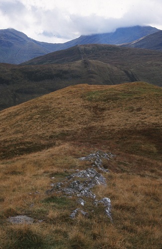
A third possibility is that the names Druim Alban and dorsum Britanniae referred, quite literally, to a feature that did indeed resemble a backbone. I first encountered this idea fifteen years ago in an article in the Pictish Arts Society Journal. The authors – David Dorren and Nina Henry – had noticed something unusual as they stood on top of Beinn Bheag, a hill slightly north-west of Tyndrum:

‘From its summit, looking south across Glen Lochy to the Ben Lui range, one sees a remarkable sight. Running straight up the hillside above Lochan na Bi and continuing in a straight line over the top of Meall Odhar is a ridge, resembling a massive field dyke superimposed on the hillside. It has a low cover of vegetation, except for a central strip on the top of the ridge, where the bare rock is exposed, forming a rocky line of approximately constant width. The rock is quartz-veined schist, which gives it a whitish appearance, so that it stands out prominently against the hillside.’ [Dorren & Henry 2000, 42-3]

The feature to which they referred can be seen in the following images:

Druim Alban

The ridge from Beinn Bheag looking south across Glen Lochy and the Lochan na Bi.
(© David Dorren 1999)

Druim Alban

View south from Beinn Bheag showing the north section of the ridge (foreground) and the more prominent section across Glen Lochy and Lochan na Bi.
(© David Dorren 1999)

Dorren and Henry also noticed that the ridge reappeared on the north side of Glen Lochy, where the white quartz is hidden under grass. This section is followed by the old county boundary (now the boundary between the Argyll and Stirling council areas). The section on the south side of the glen climbs the hillside above Lochan na Bi before curving over the top where it is known as Drochaid an Droma, ‘The Bridge of the Ridge’. Here, the rocks have a segmented appearance, just like the vertebrae of a backbone. Glen Lochy lay on one of the main routes between Dál Riata and Pictland and was perhaps crossed here by an ancient frontier which later became a county boundary. In their article, Dorren and Henry suggested that this frontier may have been marked by the quartz ridge running across the glen, and that the ridge might be the Druim Alban and dorsum Britanniae of the medieval texts.

I’ll end this blogpost with three images of the Drochaid an Droma. David Dorren – who took these photographs – tells me that when sunlight strikes the ridge, illuminating the rocks, the white quartz gleams in a stunning display.

Drochaid an Droma

The top of the ridge south of the Lochan na Bi – the Drochaid an Droma.
(© David Dorren 1999)

Drochaid an Droma

The Drochaid an Droma.
(© David Dorren 1999)

Drochaid an Droma

The Drochaid an Droma from the west. Glen Lochy to the left.
(© David Dorren 1999)

* * * * *

Notes & references

I am very grateful to Dr David Dorren for granting permission to reproduce his photographs.

J.D. Dorren and N. Henry, ‘Identification of Druim Alban’ Pictish Arts Society Journal (no.15, 2000), 42-8.

Philip M. Dunshea, ‘Druim Alban, Dorsum Britanniae – the Spine of Britain’ Scottish Historical Review 92 (2013), 275-289.

Philip M. Dunshea, In search of Carn Droma: exploring the boundaries between Picts and Gaels. [published at the blog of the ASNC Department, University of Cambridge)

Dr Dunshea’s investigation of the possible site of Carn Droma can also be seen in a site report at the West of Scotland Archaeology Service.

Adomnán’s ‘Life of Columba’ mentions Dorsum Britanniae in Book I (chapter 34), Book II (chapters 31, 42 & 46) and Book III (chapter 14).

See also the Annals of Ulster, under the year 717:
Expulsio familie Ie trans Dorsum Brittanie a Nectano rege.
‘Expulsion of the community of Iona beyond the Ridge of Britain by king Nechtan.’
[Nechtan, king of the Picts, expelled the Columban monks from his kingdom during a programme of ecclesiastical reforms.]

* * *

Additional notes [22 February 2015]

Since uploading this blogpost, I have received more information from David Dorren about the article in the Pictish Arts Society Journal (cited above). David is happy to send a copy of the article to anyone who is interested. He can be contacted at jddorren@gmail.com. A copy was also deposited at the National Library of Scotland and is on file there.

The quartz ridge can be seen on satellite images, and David has kindly provided the following links (via Bing Maps) –
1. Overall view (best viewed full-screen, from which you can zoom in or out and move around)
2. Close up of the area of the Drochaid an Droma

* * *
Additional notes [4 March 2015]

I’ve had further discussion with David Dorren on a number of points relating to Druim Alban. David has drawn my attention to a couple of points that I feel are worth adding to this blogpost. Both relate to place-names previously mentioned above.

1. Carndroma/Carndrome/Carn Druim
In their article in the Pictish Arts Society Journal, David and Nina suggested that Carndroma or Carn Druim is probably the Drochaid an Droma rather than a specific cairn. In this instance, Gaelic carn would refer to a cairn-like natural feature, a description that certainly fits the rugged appearance of the Drochaid.

2. Tyndrum
Also in the same article is the suggestion that Tyndrum, the ‘house of the ridge’, perhaps takes its name from the linear feature of which the Drochaid an Droma is the most spectacular part. This might be the case even if the feature in question is not the Druim Alban of ancient lore. Tyndrum is about 1½ miles from the Drochaid and does not itself sit on a ridge, but was presumably named from such a feature in the local landscape.

* * * * * * *

The Battle of Mugdock (AD 750)

Battle of Mugdock

Pictish warriors on an 8th-century sculptured stone at Aberlemno in Angus.


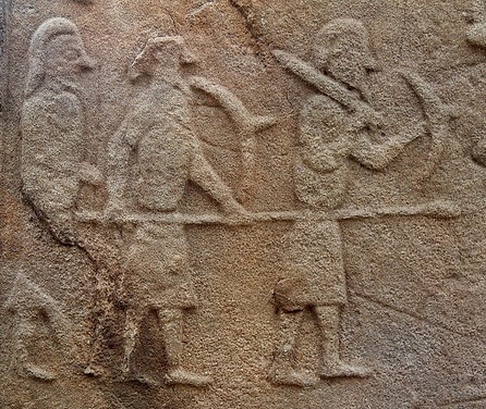
In the eighth century, under the rule of their king Onuist son of Urgust (Óengus mac Fergusa), the Picts became the dominant power in North Britain. Onuist had secured his position as the paramount Pictish king by destroying various rivals during a series of bitter conflicts in the late 720s. Early in the following decade he invaded Dál Riata, the homeland of the Scots, ravaging much of it and bringing the rest under his authority. By 740, the two main kingdoms of Dál Riata, based respectively in Lorn and Kintyre, were effectively his vassals.

From this position of strength, and with formidable military resources at his disposal, Onuist turned his eye southward to the land of the Clyde Britons. These people were ruled by their own kings whose stronghold lay on the summit of Alt Clut, the towering ‘Rock of Clyde’ at Dumbarton (Gaelic Dùn Breatainn, ‘Fortress of the Britons’). To Onuist, the Britons were a rival power whose independence posed an obstacle to his ambitions. so he challenged them to battle. The ensuing clash occurred in 744, at a site whose name is not recorded. We do not know the result: it may have been inconclusive, with neither side claiming victory. Six years later, the two armies met again, but this time the outcome was not in doubt:

‘A battle between Picts and Britons, and in it perished Talorcan, son of Urgust, and his brother; and there slaughter was made of the Picts along with him.’

This information comes from from the Annals of Tigernach, a medieval Irish chronicle. The same battle is mentioned in another Irish source, the Annals of Ulster, where the location is given a name:

‘The battle of Catohic between Picts and Britons, and in it fell Talorcan, son of Urgust, the brother of Onuist.’

The name ‘Catohic’ is obscure and otherwise unknown. It appears in no other source, nor can it be identified on a modern map. The same can be said of the name ‘Ocky’ which appears in a third Irish chronicle, the Annals of Clonmacnoise (see Appendix 3 below). A more intelligible name is provided by Annales Cambriae, the Welsh Annals:

‘A battle between the Picts and the Britons; that is, the battle of Mocetauc, and their king Talorcan was slain by the Britons.’

Also from Wales comes Brut y Tywysogion (‘Chronicle of the Princes’) which has the following entry:

‘In the same year [i.e. 750] was the battle of Mygedawc, where the Britons were victorious over the Pictish Gaels after a bloody battle.’

A different version of Brut y Tywysogion also refers to the battle but, like the Irish chronicles, it names the Pictish commander:

‘750 years was the age of Christ when there was a battle between the Britons and the Picts, in the field of Maesydawc. And the Britons slew Talorcan, king of the Picts.’

Mocetauc and Mygedawc are variant spellings of the same name. Their pronunciation is similar: in both, the consonants are pronounced ‘hard’, i.e. c has the sound of k (not s) and g is not softened to j. Maesydawc seems to be a different name, although it shares a similar ending with Mocetauc and Mygedawc and might be related to them in some way.

Our final piece of information comes from the Annals of Tigernach which report a death under the year 752:

‘Teudubur, Beli’s son, king of Alt Clut [died].’

This king is also named in a medieval Welsh genealogy or ‘pedigree’ of the kings of Alt Clut. He seems to have ruled the Britons for thirty years, from 722 to 752, and is probably the man to whom the great victory of 750 should be credited. There is some doubt as to whether he really did die in 752, with some historians wondering if the Irish annalists noted his death a couple of years too late. The Welsh Annals assert that he died in 750 and it is possible that this is correct.

Taken together, then, the Irish and Welsh sources tell us that a major battle was fought in 750, at Mocetauc or Mygedawc, a place which may also have been called Maesydawc, ‘Catohic’ or ‘Ocky’. It was a massive setback for the Pictish king Onuist, whose own brother Talorcan fell among the casualties. The victor was most likely Teudubur, king of Dumbarton, who died later in the same year or in 752. In Pictland, the defeat seems to have had major repercussions, for the Annals of Ulster tell us that the year 750 marked ‘the ebbing of the sovereignty of Onuist’. Maybe his rivals at home perceived that he was not invincible and began to stir against him? The Britons, by contrast, would have celebrated one of the greatest military successes in their history. They had thwarted the ambitions of the mighty Onuist. They had slain his brother Talorcan, a seasoned commander who had played a key role in the Pictish conquest of Dál Riata. The importance of the battle is therefore not in doubt. But where was it fought?

Battle of Mugdock

North Britain in 750.

Location

In the late nineteenth century, the Scottish historian William Forbes Skene identified Mocetauc/Mygedawc as Mugdock in Strathblane, the valley of the Blane Water. This was a logical deduction and is now generally accepted by place-name experts. At the time of the battle, Strathblane was an area where Cumbric – a language closely related to Welsh – was the everyday speech of the inhabitants. Cumbric was the language of the Clyde Britons, whose kings almost certainly held authority in Strathblane from their stronghold at Dumbarton. It is likely that Mugdock is a name of Cumbric origin, a relic of the period when many places around the Clyde had ‘Welsh-sounding’ names.

Skene was a leading figure in Scottish antiquarian circles and his influence is still felt today. His identification of Mugdock as the site of a famous Dark Age battle seems to have prompted his contemporary John Guthrie Smith, a resident of the Strathblane valley, to pinpoint the location more closely. In his book The Parish of Strathblane, published in 1886, Smith connected the battle with various local sites. He called the Britons ‘Cymry’ (pronounced Cum-ree), a term still in use today among native-speakers of Welsh. It means ‘compatriots’ or ‘fellow countrymen’. The northern equivalent was Cumbri, hence Smith’s use of Cumbria as a name for the land of the Clyde Britons. In the following passage, he offers a detailed account of the battle of Mocetauc:

“The field of this battle can be traced with but little difficulty. The Cymric army was posted on the high ground on Craigallian – then part of Mugdock – above and to the east and west of the Pillar Craig, with outposts stationed on the lower plateau to the north, and there awaited the Picts, who came up Strathblane valley through Killearn from the north on their way to the interior of Cumbria. Near the top of the Cult Brae, in a line with the Pillar Craig, there is a rock still called Catcraig, i.e., Cadcraig, meaning the “Battle Rock,” and in their efforts to dislodge the Cymric army, whom they could not leave in their rear to fall upon them when they had passed, the Picts doubtless had penetrated thus far and here the battle began. It was continued all over Blair or Blairs Hill, i.e., the “Hill of Battle” – the rising ground on Carbeth Guthrie which commands the valley of the Blane – and Allereoch or Alreoch, i.e., the “King’s Rock,” was certainly so named from being the place where King Talargan fell when the defeated Picts were being driven back to the north-west. The standing stones to the south-east of Dumgoyach probably mark the burial place of Cymric or Pictish warriors who fell in the bloody battle of Mugdock.” [Smith, Parish of Strathblane, p.8].

This romantic reconstruction owes more to Victorian imagination than to eighth-century history. Nevertheless, some parts of it can be accepted as broadly accurate. The Pictish army probably did come down from the north before marching south along the valley of the Blane Water, and the Britons may indeed have relied on lookouts or ‘outposts’ for news of the enemy’s advance. But the rock Catcraig is unlikely to commemorate this battle or any other, despite Smith’s belief that the name is significant (cat or cad is a common word for ‘battle’ in both Gaelic and Cumbric). There are, in fact, many Catcraigs in Scotland but most – if not all – have a name meaning simply ‘rock of the wildcat’. Blair Hill or Blairs Hill likewise has a first element formed from Gaelic blar (‘field’ or ‘plain’), another common element in Scottish place-names. Although blar occasionally appears in the context ‘field of battle’ this is not its primary meaning and it generally appears without any military connotation. The supposed ‘King’s Rock’ at Alreoch is more likely to be ‘speckled rock’ (from Gaelic riabhach) and, although the standing stones of Duntreath near Dumgoyach are undoubtedly ancient, there is no reason to associate them with an early medieval war-grave. Their origin lies much further back, in prehistoric times.

The simple truth is that we cannot reconstruct the progress of the battle of Mugdock in any great detail. We cannot even be sure that it was fought near the present-day Mugdock hamlet rather than elsewhere in Strathblane – the name ‘Mugdock’ was formerly attached to a medieval barony encompassing much of the valley. In cases such as this, where precise geographical details are unknown, it is often tempting to look for suggestive clues in minor place-names. This was the strategy chosen by John Guthrie Smith but it didn’t bring much clarity to the picture and merely threw up a few red herrings. A more objective approach is to step back from the local maps to consider the battle of 750 in its broader geographical and political contexts.

Alt Clut, Dumbarton Rock

Alt Clut, the Rock of Clyde at Dumbarton, Fortress of the Britons (Photo © B Keeling).

Allies and enemies

In 2009, the Canadian historian James E. Fraser discussed the significance of the battle of Mugdock in his book From Caledonia to Pictland. Fraser believed that the Pictish defeat and the subsequent ebbing of Onuist’s power ‘probably shook northern Britain’. He also suggested that the Clyde Britons may have regarded their victory as comparable to the famous defeat of an invading English army by the Picts at Dun Nechtain in 685. Both battles, as Fraser observes, seem to have thwarted ‘the imperial designs of a neighbouring superpower’. We should therefore be in no doubt that the clash at Mugdock was one of the most important battles in the history of early medieval Britain.

Fraser suggested that the battle should be seen not in isolation but as part of a much wider picture of wars and alliances. Ten years earlier, in 740, Onuist had previously come into conflict with Northumbria, the powerful English kingdom beyond his southeastern border. Contemporary English sources claim that he had an alliance with Mercia, Northumbria’s traditional enemy in the English midlands, and that the Mercians invaded Northumbria from the south in the same year. During the 740s, Onuist managed to settle his differences with the Northumbrian king Eadberht and, by the end of the decade, the two had become allies. They had much in common: both were men of ambition, keen to expand their respective realms; both faced a serious obstacle to their expansion – the kingdom of the Clyde Britons. In 750, Eadberht marched west into what is now Ayrshire, seizing the plain of Kyle together with ‘other districts’. These lands were almost certainly taken from Britons, perhaps from subordinates of the king of Alt Clut. One key question is whether the conquest of Kyle occurred before or after the battle of Mugdock. Before is surely more likely, for Eadberht may have been less keen to menace the fringes of a kingdom whose army had recently smashed the fearsome Pictish war-machine. This would be consistent with Northumbria’s apparent neutrality when Talorcan moved against the Britons: Eadberht probably thought the Picts fully capable of rampaging all the way down Strathblane to threaten Dumbarton itself. If he had foreseen that his allies would fail so spectacularly, he might have been tempted to bring his own forces into Clydesdale from the south, to boost Talorcan’s chance of victory.

Battle of Mugdock

Places connected with the Battle of Mugdock, superimposed on a modern map.

The road to war

Turning now to the circumstances of the battle, we can make a few observations about its logistical aspects: the routes of approach to the battlefield and how long each army took to get there. There can be little doubt that the Picts entered Strathblane from the north. As John Guthrie Smith envisaged, they probably came via Killearn. This village stands on an old route running from Dumbarton to the ancient Fords of Frew, a crossing-point on the River Forth still used by armies as late as 1745. It is likely that Talorcan and his warriors, marching south from their Perthshire heartlands, crossed at Frew before turning southwest towards Killearn. The Pictish army would have been a mixture of horsemen and foot-soldiers, all travelling at an average rate of no more than 25 miles per day. The terrain would not have been easy, for there were no long stretches of well-maintained highway. Moreover, this was long before the extensive wetlands of the Forth Valley were drained and reduced. Progress across the treacherous mosses would have been slow for man and beast alike. The distance from Strathearn, a plausible mustering-point for Talorcan’s army, to the area around Mugdock is roughly 30 miles. This probably meant a 2-day journey for the Picts, even if they maintained a steady march-rate of 15 miles per day, with essential rest-periods for horses. After crossing the Fords of Frew they probably came into lands that acknowledged Teudubur as king. Here, the invaders no doubt began to ravage the countryside by burning farmhouses and terrorising the people, before making camp as evening fell. Meanwhile, news of the onslaught would have been sent to Alt Clut by the swiftest means, prompting Teudubur to respond by mustering his own forces quickly. He may even have been expecting an attack, or it may have come without warning.

The Britons had a shorter and less arduous trek to the battlefield. From their fortress at Dumbarton, they would have gone via Duntocher and Milngavie to enter the Strathblane valley, picking up the route of today’s A81 highway. The entire distance from Dumbarton to Mugdock hamlet was only 10 miles, a distance easily completed within a half-day’s march. The Britons probably reached the middle of the valley some hours before the enemy. This would have allowed them enough time to choose the battlefield and to post lookouts – the ‘outposts’ imagined by Smith. The ensuing contest would have been brief and bloody, a horribly gruesome spectacle involving a tangled mass of foot-soldiers hacking and stabbing amid a clamour of yells and screams. Cavalry did not necessarily play a major role, even if some warriors rode to the battlefield. Although we see carvings of armed horsemen on Pictish stones, there is no strong evidence that mounted combat was a regular feature of warfare in eighth-century Britain. The battle of Mugdock is more likely to have been a fight between two infantry armies. At some point, after a few hours of relentless carnage, the Picts broke and fled. Few would have escaped the field alive; fewer still would have come home to the farmlands of Perthshire.

Mugdock Castle

Mugdock Castle (from J.G. Smith’s Parish of Strathblane)

Aftermath

Teudubur’s great victory enabled his people to avoid the fate of their Scottish neighbours: Dál Riata seems to have remained under Pictish overlordship until the middle of the ninth century, when Viking raids disrupted the status quo, but the Clyde Britons appear to have remained independent. This is remarkable when we consider that they endured another Pictish invasion six years after their triumph at Mugdock. The aggressor was again Onuist, but this time he was taking no chances. Not only did he command the army himself, he co-ordinated the attack with his English ally Eadberht who simultaneously led a Northumbrian force into Clydesdale. Faced with overwhelming odds, the king of the Britons – Teudubur’s son Dyfnwal – surrendered at Dumbarton on 1st August 756. This was a war Dyfnwal could not hope to win. However, there is no hint that his capitulation heralded a long period of subjugation to Pictish or English overlords. Eadberht tasted the fruits of victory for a mere nine days: on 10th August, his army was butchered in a sudden ambush as it marched home from Govan on the south bank of the Clyde. Some historians think the unidentified attackers were vengeful Britons, others think the Picts were responsible. Onuist himself returned home safely, laden with plunder, but he had fought his last campaign. We hear no more of him until his death in 761. His successors maintained the Pictish overlordship of Dál Riata but there is no evidence that the kings of Alt Clut were similarly reduced as vassals. Not until the eleventh century, when the Picts and Scots were united in the powerful new kingdom of Alba, did Teudubur’s descendants finally relinquish their independence.

St Andrews Sarcophagus

This image of the Israelite king David on the 8th-century St Andrews Sarcophagus may be a contemporary likeness of Onuist, king of the Picts (Photo © B Keeling).

* * *

Appendix 1: Dineiddwg

In the early twentieth century, a large mansion was built at Mugdock for the wealthy Glasgow baker William Beattie. It was given the name ‘Dineiddwg’ because this was commonly assumed to be the ancient name of Mugdock. The assumption was actually not much older than the mansion itself, having arisen from a footnote in one of W.F. Skene’s books, The Four Ancient Books of Wales, published in 1868. Skene drew attention to a medieval Welsh poem attributed to the bard Taliesin who allegedly lived in North Britain in the sixth century. The poem ends with the following lines:

Rwg kaer rian a chaer rywc
rwg dineidyn. a dineidwc
eglur dremynt a wyl golwc.
Rac rynawt tan dychyfrwymwc.
an ren duw an ry amwc.

(‘Between Caer Rian and Caer Rywg,
between Dineiddyn and Dineiddwg;
a clear glance and a watchful sight.
From the agitation of fire, smoke will be raised,
and God our Creator will defend us.’)

The poem in question was composed long after the sixth century by an anonymous Welsh poet who was not Taliesin. It is allusive rather than narrative, with obscure references to nature and magic. The final lines, however, include a mention of Dineiddyn, the ancient Welsh name for Edinburgh. This led Skene to believe that the other three places – Caer Rian, Caer Rywg and Dineiddwg – were also in North Britain. Din is an old Welsh word meaning ‘fortress’, hence Edinburgh is ‘Fortress of Eiddyn’. Dineiddwg is presumably ‘Fortress of Eiddwg’ but the second element is difficult to identify. Skene wondered if it might be echoed in the names Mocetauc, Mygedawc and Maesydawc, with Dineiddwg being yet another alternative name for Mugdock. This was only a guess, but it was enough to encourage John Guthrie Smith to go even further: ‘Dineiddwg means therefore the Fort of Eiddwg or Edawc, who may have been a Cymric chief, with his castle Dineiddwg or Dinedawc standing in a commanding position on his estate Maeseiddwg or Maesedawc’. Here, Smith was simply using his imagination to create a dramatic picture out of virtually nothing. Needless to say, his 1886 book is almost certainly where William Beattie found a suitably eye-catching name for a new mansion at Mugdock.

Appendix 2: Folklore

I visited Mugdock Country Park a few years ago but didn’t have much time to explore the surrounding area. Since my visit I have learned that a sign at the nature reserve beside Loch Ardinning tells of a Dark Age battle fought in the vicinity. The sign dates this battle to 570 AD and associates it with the famous King Arthur. John Guthrie Smith knew of the tradition and connected it with a curious discovery in 1861 when railway workmen unearthed ‘an immense deposit of human and horse bones’ nearby. He also drew attention to a boulder known as Arthur’s Stone on a hillside near Craigbarnet, slightly northwest of Mugdock. I’m no great believer in the idea of a historical figure behind the Arthur legends and rarely mention the topic on this blog. The legends were, of course, widely popular in the Middle Ages and many places in Britain enthusiastically claim an Arthurian connection. At Mugdock, however, we find the curious coincidence of an alleged Arthurian battle near the site of a genuine historical one. At first glance, it is tempting to wonder if the two are connected, with the legendary King Arthur being grafted onto local traditions of the great battle of 750. Unfortunately, the possibility that a folk-memory of the Pictish defeat survived among the people of Strathblane is very remote. The area was caught up in the upheavals of the eleventh and twelfth centuries, which saw a southward expansion of the kingdom of Alba. By 1070, the land of the Clyde Britons had been conquered and absorbed. One effect of the conquest was the introduction of Gaelic speech and a new sense of ‘Scottishness’, leading to the demise of the old Cumbric language and the cultural identity it represented. Many indigenous traditions faded away and, within a few generations, the Clyde Britons had become Gaelic-speaking Scots. Almost everything of their former history was soon forgotten, including tales of heroic kings and ancient wars. By the end of the twelfth century, it is unlikely that anyone in Mugdock knew that a once-famous battle had been fought there.

Appendix 3: Primary sources

The original entries from the medieval chronicles mentioned at the start of this blogpost are listed below. Most of these texts were written in Latin, with two exceptions: Brut y Tywysogion (in Welsh) and the Annals of Clonmacnoise (a translation in seventeenth-century English).

Annals of Tigernach

750 – Cath eter Pictones et Britones, i testa Tolargan mac Fergusa & a brathair, & ár Picardach imaille friss.
752 – Taudar mac Bile, rí Alo Cluaide.

Annals of Ulster
750 – Bellum Catohic inter Pictones & Brittones in quo cecidit Talorggan mc. Forggussa, frater Oengussa.

Annals of Clonmacnoise (misdated the battle by 4 years)
746 – The battle of Ocky between the Picts & Brittans was fought where Talorgan mcffergus, brother of K. Enos, was slaine.

Annales Cambriae or ‘Welsh Annals’
750 – Bellum inter Pictos & Brittones, id est gueith Mocetauc. Et rex eorum Talargan a Brittonibus occiditur. Teudubur filius Beli moritur.

Brut y Tywysogion (‘Red Book of Hergest’ version)
Deg mlyned a deugeint a seith cant oed oet Crist pan vu y vrwydyr rwg y Brytanyeit ar Picteit yg gweith Maesydawc ac y lladawd y Brytanyeit Talargan brenhin y Picteit.

* * * * *

Notes & references

I was inspired to write this blogpost after conversations on Twitter with Debra Torrance of Milngavie.

Indigenous Archaeology in and around Milngavie is a local heritage group whose interests cover the Mugdock area. Take a look at their Facebook page.

John Guthrie Smith, The parish of Strathblane and its inhabitants from early times : a chapter in Lennox history (Glasgow, 1886)

James E. Fraser, From Caledonia to Pictland: Scotland to 795 (Edinburgh, 2009)

W.F. Skene’s note on Dineiddwg appears on page 401 in Vol.2 of his book The Four Ancient Books of Wales (Edinburgh, 1868).

I mention the battle of Mugdock in my books The Men of the North: the Britons of Southern Scotland and The Picts: a history.

James Johnston in his 1904 book The Place-Names of Stirlingshire suggested (at page 54) that the name Mugdock is of Gaelic origin: mag-a-dabhoich, ‘plain of ploughed land’. But it is more likely to be a pre-Gaelic, Cumbric name, as both W.F. Skene and John Guthrie Smith implied in their notes on Dineiddwg.

The name ‘Catohic’ from the Annals of Ulster is very obscure. I have been unable to find any information on it. The same can be said of ‘Ocky’ in the Annals of Clonmacnoise. Both might be scribal errors due to miscopying of the original names.

A description of the Duntreath standing stones can be found on the Canmore database.

* * * * * * *

This post is part of the Kingdom of Strathclyde series:

Kingdom of Strathclyde

* * * * * * *

The Legend of Luncarty

Shield of Clan Hay

Shield of Clan Hay


Although this blog is mainly concerned with history and archaeology, it does occasionally feature myths and legends, especially those in which real historical figures from the early medieval period are mentioned. Needless to say, the boundaries between history and myth are not always clear-cut. Take, for example, the origin-tales of Scottish clans. These traditional stories – often passed down through countless generations – purport to explain when, where and by whom a particular clan was founded. Such tales are important literary relics in their own right – as repositories of old folklore – but they also have special value to genealogical researchers, particularly to present-day bearers of a clan surname who want to know how old their name is and what it means.

I have no Scottish ancestry (as far as I know) but I do have an interest in the origins of a number of Scottish clans, mainly those which claim to have been founded before c.1100. I am especially interested in clans with alleged Norman, Viking or Pictish origins, as well as in a few others (such as Clan Galbraith) whose beginnings seem to lie in the ancient kingdom of Strathclyde.

In this blogpost I’ll be looking at the origins of Clan Hay, whose principal line has held the earldom of Errol in Perthshire since the late twelfth century. The traditional story associates the founding of the clan with a battle at Luncarty, 4 miles north of Perth, sometime around the year 980. The two opposing sides were Scots and Vikings, the former being led by a king called ‘Kenneth’. According to this tale, the Vikings (described as ‘Danes’) succeeded in routing the right and left flanks of the Scottish army. King Kenneth, still fighting in the centre, could only watch in dismay as a large number of his warriors fled in panic. Meanwhile, in a nearby field, a local farmer and his two sons were ploughing with oxen. Pausing to watch the battle, they were enraged to see their fellow-Scots running away, so they decided to block the escape-route. Unfastening the wooden yokes from their oxen they used these heavy implements as improvised weapons, smiting not only their fleeing countrymen but also any Viking pursuers. They then rallied the Scots for a counter-attack which utterly surprised the Danes, who thought a new Scottish army was charging at them. Victory was thus snatched from the jaws of defeat. A grateful King Kenneth rewarded the farmer – whose name was Hay – with a generous gift of land and a coat of arms, instantly elevating him from lowly peasant stock to the ranks of the landowning aristocracy. The coat of arms was a background of argent (‘silver’ or white in heraldry) emblazoned with three bloodstained shields. To define the location and size of Hay’s new territory, the king released a falcon from the summit of a hill, decreeing that the course of the bird’s flight would mark the boundaries. The land in question comprised what would later become the earldom of Errol, the ancestral domain of Clan Hay.

map_luncarty2

This tale, sometimes known as the Legend of Luncarty, first appeared in written form in Hector Boece’s Historia Gentis Scotorum (History of the Scottish People) of 1527. Boece is not regarded as a reliable historian. In fact, his work is even less trustworthy than the imaginative pseudo-chronicles produced by earlier writers such as Walter Bower and John of Fordun (fifteenth and fourteenth centuries respectively). No ancient source mentions a tenth-century battle at Luncarty. The earliest reference comes from Bower who briefly describes the battle, though without connecting it to the origins of Clan Hay. Most Scottish historians in the centuries after Boece have regarded both the battle and the legend as fictional. Some have even proposed that Boece invented the entire story – a rather extreme opinion, since it is probably more likely that the key elements originated with the earls of Errol themselves as a suitably heroic account of their family’s origins. Indeed, the roots of the legend seem to lie in the landscape around Luncarty, where prehistoric burial-mounds and standing stones may have inspired local storytellers to imagine an ancient conflict having been fought there. In the vicinity stands Turnagain Hill, whose enigmatic name may have demanded a dramatic explanation (such as an unexpected counter-attack by fleeing Scots). There is also a farm called Denmarkfield that is said to mark the site of the battle.

One element of the legend that seems at least to be based on real history is the figure of ‘King Kenneth’, who is presumably Cináed mac Maíl Coluim (Kenneth, son of Malcolm), king of Scots from 971 to 995. Cináed appears in a number of fairly reliable sources such as the Chronicle of the Kings of Alba. From these we learn that he fought against the English of Northumbria and the Strathclyde Britons, but there is no record of a war against Danish invaders in his Perthshire heartlands. In 977, at an unnamed battle, he defeated and killed a rival who bore the distinctly Scandinavian name Anlaf. Although this Anlaf was a Scottish prince and a kinsman of Cináed, he may have had Viking ancestry and was possibly the grandson and namesake of one of the Norse kings of Dublin (two of whom were called Anlaf). Perhaps the historical tenth-century battle in which Anlaf perished was the inspiration for the Hay legend? If so, it may even have been fought at Luncarty. Whatever the truth of the matter, there can be little doubt that the legend was already in existence when Boece published it in 1527. Walter Bower’s brief mention of a victory won by King Kenneth over Danish invaders at Luncarty seems to be drawn from the same tradition, suggesting that a version existed in the 1400s. Bower thus provides us with a historical horizon for the legend. Unfortunately we cannot trace its roots back any further.

Clan Hay now acknowledges a more authentic account of its ancestry in which the clan forefather was not a tenth-century Scottish peasant but a twelfth-century Norman knight called William de Haya. William was probably born sometime around the year 1130 on his family’s estates at La Haye Hue in the southern part of Normandy’s Cotentin Peninsula. He may have been a direct descendant of the Viking settlers (‘Northmen’) from whom Normandy is named. The place-name La Haye derives from an old Germanic word meaning ‘hedge’, perhaps a reference to defensive stockades or field boundaries. La Haye Hue is now La Haye-Bellefond.

Map of Normandy

William de Haya’s mother Juliana de Soulis came from another Norman family whose lands lay adjacent to those of his father (also called William). Juliana’s brother Ranulf de Soulis (born c.1090) acquired land in England through his friendship with the Scottish prince David, who had spent much of his early life at the English royal court. At that time, England was ruled by a Norman dynasty founded by William the Conqueror in 1066. When David left England and returned to Scotland – probably in 1113 – he was accompanied by many Anglo-Norman knights. At that time, his brother Alexander held the Scottish throne. Alexander allowed David to rule a large region known as ‘Cumbria’ – the former kingdom of Strathclyde – as a kind of autonomous princedom. Within this area David installed his Norman friends as barons, effectively setting them up as powerful Scottish lords. One of these was Ranulf de Soulis who received the barony of Liddesdale on the English border. In 1124, David succeeded Alexander as king of Scotland and reigned for nearly thirty years. Ranulf remained at his side as a faithful companion, eventually becoming the king’s Cup-bearer – a symbolic but highly influential position at the royal court. David’s long reign saw more Norman knights settle in Scotland, one of these being the younger William de Haya, who was no doubt invited over from Normandy by his uncle Ranulf. William’s career can be traced through contemporary charters in which his name appears as a witness to land-grants made by Scottish kings. These documents support the view that he was the first member of the de Haya family to arrive in Scotland. It has been suggested that the English branch of the Hays are related to their Scottish cousins through an ancestor who arrived with William the Conqueror’s invasion force in 1066.

King David I of Scotland

After David’s death in 1153, the Scottish crown passed to his grandson Máel Coluim. By 1160, Máel Coluim’s Cup-bearer was none other than William de Haya, who had risen to become a powerful figure at court. William married a Scottish noblewoman called Eva, through whom he acquired estates at Pitmilly in Fife. He later received the lands of Errol and erected there a motte (artificial mound) for a new castle. His descendants, the earls of Errol, became the hereditary chiefs of Clan Hay. William is believed to have lived to a ripe old age, probably dying sometime around the year 1201.

* * * * *

Notes & links

Clan Hay is not the only Scottish clan whose origins lie in Normandy. I intend to look at one or two others in future blogposts.

Clan Hay has an official website.

The clan’s Norman ancestry was explored by Sir Anthony Wagner in his two-part article ‘The Origin of the Hays of Erroll’, published in the Genealogists’ Magazine in 1954-55 (volume 11, pages 535-40 and volume 12, pages 1-6).

Aerial photographs of the alleged site of the Battle of Luncarty can be seen at the Canmore database.

A picture of the Hawk’s Stone, where King Kenneth’s falcon supposedly landed after its flight, can be seen in a post at the Bletherskite website.

The second edition of Hector Boece’s Historia was published in 1575. An online version of this, edited by Dana F. Sutton, is available via the University of Birmingham’s Philological Museum. The Legend of Luncarty appears in Book XI and can be accessed via the links below, in both Latin and English. I’ve also included a link to Professor Sutton’s introduction, which places Boece in the wider context of Scottish medieval historiography.

The Legend of Luncarty: Latin text / English translation.
Introduction to Dana F. Sutton’s edition of Boece’s Historia.

* * * * * * *

Saints in Scottish Place-Names

Keills Cross Knapdale

Ancient chapel and cross at Keills in Knapdale, beside Loch Sween. Photograph by Erskine Beveridge in The Early Christian Monuments of Scotland (1903).


A research project in the School of Humanities at the University of Glasgow has produced a fascinating online resource: a searchable database of hagiotoponyms in Scotland. Hagiotoponyms are place-names that commemorate saints. They are found all over the Scottish landscape as names of old parishes, medieval churches, holy wells and standing stones. Many of them give clues about the geography and chronology of the cults of saints. In some cases, the cult is localised to one small district or even to a single site. In others, the cult is linked to important religious or political changes that affected a very large area. The introduction of the cult of St Andrew, for example, was obviously significant in the evolution of a national ideology for the kingdom of Alba. On a regional level, the promotion of Mungo (Kentigern) as the patron saint of Glasgow seems to have played a role in the Gaelicisation of Strathclyde.

The original project was called Commemorations of Saints in Scottish Place-Names. It gathered information on a bewildering number of hagiotoponyms, ranging from the well-known (e.g. St Andrews) to the obscure (e.g. Exmagirdle). The project team clearly worked hard, for the resulting database is huge: 13000 place-names, 5000 places, 750 saints. I only wish it had been up and running a couple of years ago, when I was writing my book on Saint Columba. Back then, my main source of toponymic information was the ever-redoubtable CPNS (aka William Watson’s History of the Celtic Place-Names of Scotland) but an online resource would have been a useful quick-reference tool. Databases are always faster than printed book-indexes when you’re trying to work out which Kildonan is the one you really need.

The link below will take you straight to the database. Enjoy!

Saints in Scottish Place-Names

* * * * *

Notes, references & more links

Terry O’Hagan wrote on this topic at the Vox Hiberionacum blog last month. Terry is a specialist on Early Irish Christianity, which means he knows a thing or two about Scotland as well. Follow him on Facebook and Twitter if you’re interested in Celtic saints.

In addition to the database, the project Commemorations of Saints in Scottish Place-Names has its own webpage at the University of Glasgow.

William Watson, The History of the Celtic Place-Names of Scotland (Edinburgh, 1926). This indispensable tool for students of early Scottish history is available as a paperback from Birlinn Books.

Birlinn is also the publisher of my book on Saint Columba.

columba_cover2

* * * * * * *

Brunanburh in 937: Bromborough or Lanchester?

King Athelstan

Athelstan, king of the English (924-39), in a manuscript of Bede’s Life of St Cuthbert.


Last Thursday evening (4th December) the eminent philologist Andrew Breeze gave a lecture to the Fellows of the Society of Antiquaries at their headquarters in London. His main topic was the battle of Brunanburh, fought in 937, one of the most famous events of the Viking Age. The victor was the English king Athelstan who thwarted an alliance of Norsemen, Scots and Strathclyde Britons. Frustratingly, the site of this mighty clash of arms is unknown. Some historians think it took place on the Wirral Peninsula in Cheshire, near the present-day village of Bromborough. Others think Cheshire is too far south and instead suggest alternative locations, one of these being the River Browney in County Durham. Professor Breeze believes that the Roman fort of Lanchester, slightly north of the Browney, may be the lost ‘fort of Bruna’ implied by the Old English place-name Brunanburh.

The lecture is now available on YouTube. Although I’m not convinced by the Lanchester theory, I like to keep up with the Brunanburh debate so I enjoyed watching the video. At the heart of Professor Breeze’s argument is his belief that the Norsemen sailed in via the Humber estuary – as indeed the twelfth-century chronicler John of Worcester said they did – before mooring their ships and marching to the battlefield. Not everyone is happy to accept the chronicler’s words on this important logistical point. Some sceptical folk (myself included) think it more likely that the Norse commander Anlaf Guthfrithsson brought his army across the Irish Sea to a landfall on the western coast of Britain. The earliest source for the battle of Brunanburh is a tenth-century poem which says that Anlaf fled across the sea to Dublin after his defeat. I support the theory that he probably arrived at the battlefield via the same western route rather than by sailing all the way around Scotland to come down to the Humber.

The link below will take you to the video of the lecture. Look out for a glimpse of my latest book Strathclyde and the Anglo-Saxons in the Viking Age. Needless to say, Professor Breeze isn’t convinced by what I’ve written in the book’s fifth chapter, which mostly deals with the Brunanburh debate. There I suggest that the great battle may have been fought in North Lancashire, although I conclude that the true location is likely to remain elusive for the foreseeable future.

Society of Antiquaries [YouTube] – Brunanburh in 937: Bromborough or Lanchester?

* * * * *

Notes

I am grateful to Andrew Breeze for telling me about the lecture and video.

A brief summary of the lecture can be seen at the Society of Antiquaries events pages.

I mentioned both Lanchester and Bromborough in a blogpost published here last October.

* * * * * * *

Kelpies

Kelpies Falkirk Helix
Old Scottish legends speak of malevolent spirits lurking in streams and pools, waiting to catch and devour unwary travellers. These dangerous beings are often shape-shifters who adopt various human or animal forms. Perhaps the most feared of all are those that appear as beautiful horses: the each uisge (Gaelic ‘water horse’) of the sea-loch and the kelpie of the riverbank. Woe betide anyone who dares to approach a sleek, dark mare grazing peacefully at the waterside. In the blink of an eye, the victim is dragged beneath the surface to be drowned and eaten.

The origin of these mythical creatures is shrouded in mystery. One theory sees them as later versions of gods and goddesses who in ancient times were associated with particular lochs and rivers. Another sees them as symbols of the real danger posed by deep or fast-flowing water. ‘Don’t go too near the loch, or the kelpie will get you!’ was no doubt a warning issued to countless generations of inquisitive children in the Highlands.

It has been suggested that the enigmatic Pictish symbol known as the ‘swimming elephant’ or ‘Pictish beast’ might represent a kelpie or each uisge. Other explanations have been put forward but, on a personal note, I quite like this one. I’m sure the Picts had their own dark tales of deadly water-spirits in equine form, and maybe these were in some way ancestral to the creatures of later folklore. The strange ‘beastie’ carved with remarkable consistency on more than fifty Pictish stones does indeed resemble a horse.

Pictish Largo stone

Pictish beast carved on a stone at Largo in Fife.

On the Pictish cross-slab in the kirkyard at Aberlemno in Angus, a pair of creatures with horse heads and fish tails intertwine in the lower right-hand corner. Although usually identified as seahorses they bear a striking resemblance to how kelpies are sometimes portrayed in later art. Many present-day artists, for example, depict the kelpie as an aquatic creature with the tail of a dolphin.

Pictish Aberlemno stone

Seahorses on the Pictish cross-slab in Aberlemno kirkyard.

In 2014, no discussion of the mythical kelpie can ignore the two magnificent examples of the species that now reside near Falkirk. These enormous steel sculptures soar into the sky, completely dominating the local landscape and dwarfing the human visitors who teem like tiny ants on the ground below. The giant Kelpies stand beside the Forth and Clyde Canal in the new Helix Park – an extensive recreation area with playgrounds, walking paths and a lagoon. Andy Scott, the sculptor who designed the Kelpies, drew inspiration not only from the water-spirits of legend but also from the powerful horses who once served heavy industry in the area. The two gigantic heads are 30 metres high and certainly exude an aura of strength and vigour, just like the Clydesdale horses on which they are modelled.

Kelpies Falkirk Helix

I’d been keen to visit the Kelpies since April, when they were officially unveiled to the public. I eventually managed to see them at the end of August. Needless to say, the experience far exceeded all my expectations. To say I was lost for words would be an understatement. Descriptions such as impressive, imposing and awesome fail to reflect the majesty and energy of these sculptures when you’re walking beneath them. Like the ancient water-spirits that inspired their making, they exude a magical aura which – judging from the faces I saw during my visit – leaves most human visitors utterly spellbound.

Kelpies Falkirk Helix

Kelpies Falkirk Helix

Kelpies Falkirk Helix

Kelpies Falkirk Helix

* * * * *

Notes & links

Archaeologist Sally Foster suggested that the mysterious ‘Pictish beast’ of the symbol stones is ‘apparently a dolphin or perhaps the fantastic kelpie or water-horse of later Scottish folklore.’ (Picts, Gaels and Scots, p.74 of the 1996 edition)

One of the most famous kelpie legends tells of the snaring of one of these creatures by the lord of Morphie (near Montrose) who forced it to drag stones for the construction of his new castle. After toiling hard with ‘sore back and sore bones’, the kelpie managed to escape, laying a curse on its cruel captor as it fled back to its pool:
‘Sair back and sair banes,
drivin’ the Laird o’Morphie’s stanes.
The Laird o’Morphie’ll never thrive
sae lang as the Kelpie is alive!’

[Link] The Kelpies sculpture website
[Link] Sculptor Andy Scott’s website

Photographs in this blogpost are copyright © B Keeling.

* * * * * * *